
File:Aerial image of Heligoland.jpg

Dimension de ci prevision: 800 × 520 pixeles. Altri resolutiones: 320 × 208 pixeles | 640 × 416 pixeles | 1,024 × 666 pixeles | 1,280 × 832 pixeles | 2,560 × 1,664 pixeles | 4,000 × 2,600 pixeles.
Original file (4,000 × 2,600 pixeles, dimension del file: 3.13 MB, tip MIME: image/jpeg)
Descrition
| Descrition |
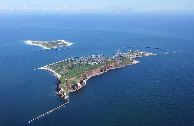
English: Aerial image of Heligoland
Deutsch: Luftbild von Helgoland |
| Date | |
| Fonte | Propri ovre |
| Autor | Carsten Steger |
| Camera location | | View this and other nearby images on: OpenStreetMap |
|---|
| Object location | | View this and other nearby images on: OpenStreetMap |
|---|
Autorisation
I, the copyright holder of this work, hereby publish it under the following license:
This file is licensed under the Creative Commons Attribution-Share Alike 4.0 International license.
- Vu es líber:
- distribuer – a copiar, distribuer e transmisser li labor
- remixter – adaptar li ovre
- Sub li conditiones quam seque:
- atribution – Vu deve dar li credite convenent, provider un catenun por li autorisation, e indicar si changes esset fat.
Vu posse far in qualcunc forme rasonabil, ma ne de forma que suggeste que li autorisator indossa vu o tui usu.
- distribuer in conditiones de egal autorisation – Si vu remixter, transformar, o constructer sur li materiale, vu deve distribuer tui contributiones sub li autorisation identic o campatabil quam li original.
This image has been assessed using the Quality image guidelines and is considered a Quality image.
|
| Annotations | This image is annotated: View the annotations at Commons |
Versiones del file
Clacca a un date/témpore por vider ti version.
| Version de | Miniatura | Dimensiones | Usator | Comentarie | |
|---|---|---|---|---|---|
| actual | 21:44, 11 septembre 2021 | | 4,000 × 2,600 (3.13 MB) | Carsten Steger | Sharpened the image. |
| 18:38, 9 julí 2021 |  | 4,000 × 2,600 (2.6 MB) | Carsten Steger | Removed two dust spots. | |
| 18:13, 9 julí 2021 |  | 4,000 × 2,600 (2.6 MB) | Carsten Steger | Uploaded own work with UploadWizard |
Usu del file
Li sequent págine usa ti file:
Usu global del file
Li altri wikis a sequer usa ti-ci file:
- Usu in ace.wikipedia.org
- Usu in an.wikipedia.org
- Usu in ar.wikipedia.org
- فريزيا (جزر)
- زولت (جزيرة)
- هيرينفين
- قالب:الجزر الفريزية
- سخيرمونيكوخ
- تيرشخيلينج
- أمالاند
- دانتوماديل
- دونجراديل
- فيرفيرديراديل
- دي فريسكه مارين
- فرانيكراديل
- أوستستالينجفيرف
- أوبسترلاند
- فليلاند
- تيسل
- الجزر الفريزية الغربية
- بوركوم
- نوردرناي
- تصنيف:جزر فريزية
- نورديرهاكس
- ريخل
- خريند
- ريف (جزيرة)
- إنجلسمانبلات
- سيمونزاند
- روتوميربلات
- روتوميرأوخ
- زاود داونتشيز
- فيرينجن
- الجزر الفريزية الشرقية
- لوتشيا هورن
- كاخيلوتبلاته
- ميمرت
- ياوست
- بالتروم
- لانجه أوخ
- سبيكيرأوخ
- فانجر أوخه
- مينسينرأوخ
- ميلوم
- باوسه
- نورك
- قائمة جزر ألمانيا
- الجزر الفريزية الشمالية
- جزيرة لوهيسن
- جزيرة فوهر
Vider plu del usu global de ti-ci file.