
File:Map of USA MD.svg

Size of this PNG preview of this SVG file: 286 × 186 pixeles. Altri resolutiones: 320 × 208 pixeles | 640 × 416 pixeles | 1,024 × 666 pixeles | 1,280 × 832 pixeles | 2,560 × 1,665 pixeles.
Original file ((file SVG, nominalmen 286 × 186 pixeles, mesura de file: 167 KB))
Clickable version
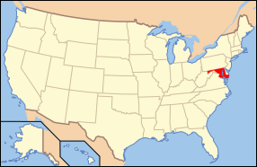
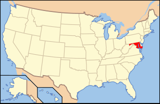
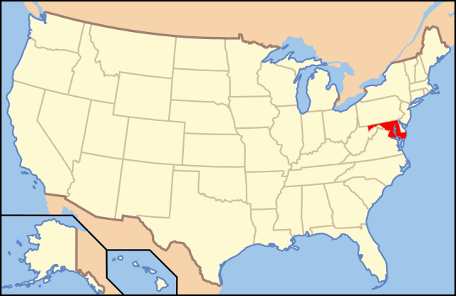
| Descrition | Map of USA with Maryland highlighted | ||||||||
| Date | see file history below. | ||||||||
| Fonte | Propri ovre (Original text: own work by uploader, Own work based on: Map of USA without state names.svg) | ||||||||
| Autor |
This version: uploader Base versions this one is derived from: originally created by Wapcaplet |
||||||||
| Permission: (Reusant ti-ci file) |
This file is licensed under the Creative Commons Attribution 2.0 Generic license.
Vu posse far in qualcunc forme rasonabil, ma ne de forma que suggeste que li autorisator indossa vu o tui usu. |
||||||||
| Other versions | Map of USA with state names.svg | ||||||||
| SVG genesis | This locator map was created with Inkscape. |

Versiones del file
Clacca a un date/témpore por vider ti version.
| Version de | Miniatura | Dimensiones | Usator | Comentarie | |
|---|---|---|---|---|---|
| actual | 13:42, 1 novembre 2012 | | 286 × 186 (167 KB) | Kmusser | remove VA portion of eastern shore |
| 09:06, 26 april 2008 |  | 286 × 186 (167 KB) | Rub1615~commonswiki | Reverted to version as of 07:11, 9 June 2006 | |
| 15:32, 23 april 2008 |  | 286 × 186 (183 KB) | Rfc1394 | Add an inset to the map enlarging the focus area to make it easier to see the designated state. | |
| 07:11, 9 junio 2006 |  | 286 × 186 (167 KB) | Huebi~commonswiki | {{Information| |Description=Map of USA with Maryland highlighted |other_versions=image:Map of USA with state names.svg }} Category:Maps of the United States Category:Maps of Maryland Category:SVG maps {{GFDL-en}}{{cc-by-2.0}}{{cc-by-sa- |
Usu del file
Li sequent págine usa ti file:
Usu global del file
Li altri wikis a sequer usa ti-ci file:
- Usu in af.wikipedia.org
- Usu in ang.wikipedia.org
- Usu in an.wikipedia.org
- Usu in arc.wikipedia.org
- Usu in ar.wikipedia.org
- Usu in arz.wikipedia.org
- Usu in ay.wikipedia.org
- Usu in az.wiktionary.org
- Usu in bg.wikipedia.org
- Usu in bi.wikipedia.org
- Usu in bo.wikipedia.org
- Usu in bpy.wikipedia.org
- Usu in bxr.wikipedia.org
- Usu in ca.wikipedia.org
- Usu in ce.wikipedia.org
- Usu in cs.wikipedia.org
- Usu in da.wikipedia.org
- Maryland
- Annapolis
- Baltimore
- Towson (Maryland)
- Worcester County (Maryland)
- Allegany County (Maryland)
- Anne Arundel County
- Denton (Maryland)
- Frederick (Maryland)
- Oakland (Maryland)
- Cumberland (Maryland)
- Sharpsburg (Maryland)
- Hagerstown (Maryland)
- La Plata (Maryland)
- Rockville (Maryland)
- Baltimore County
- Frederick County (Maryland)
Vider plu del usu global de ti-ci file.