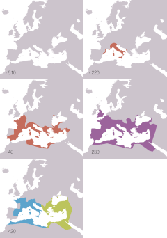
File:Roman Republic Empire map.gif

Page contents not supported in other languages.
De Wikipedia

Roman_Republic_Empire_map.gif(626 × 595 pixeles, dimension del file: 101 KB, tip MIME: image/gif, looped, 21 frames, 37 s)

Ti file es de Wikimedia Commons e posse esser usat per altri projectes. Li descrition in su págine de descrition es monstrat in infra.

Bună

Descrition

Descrition
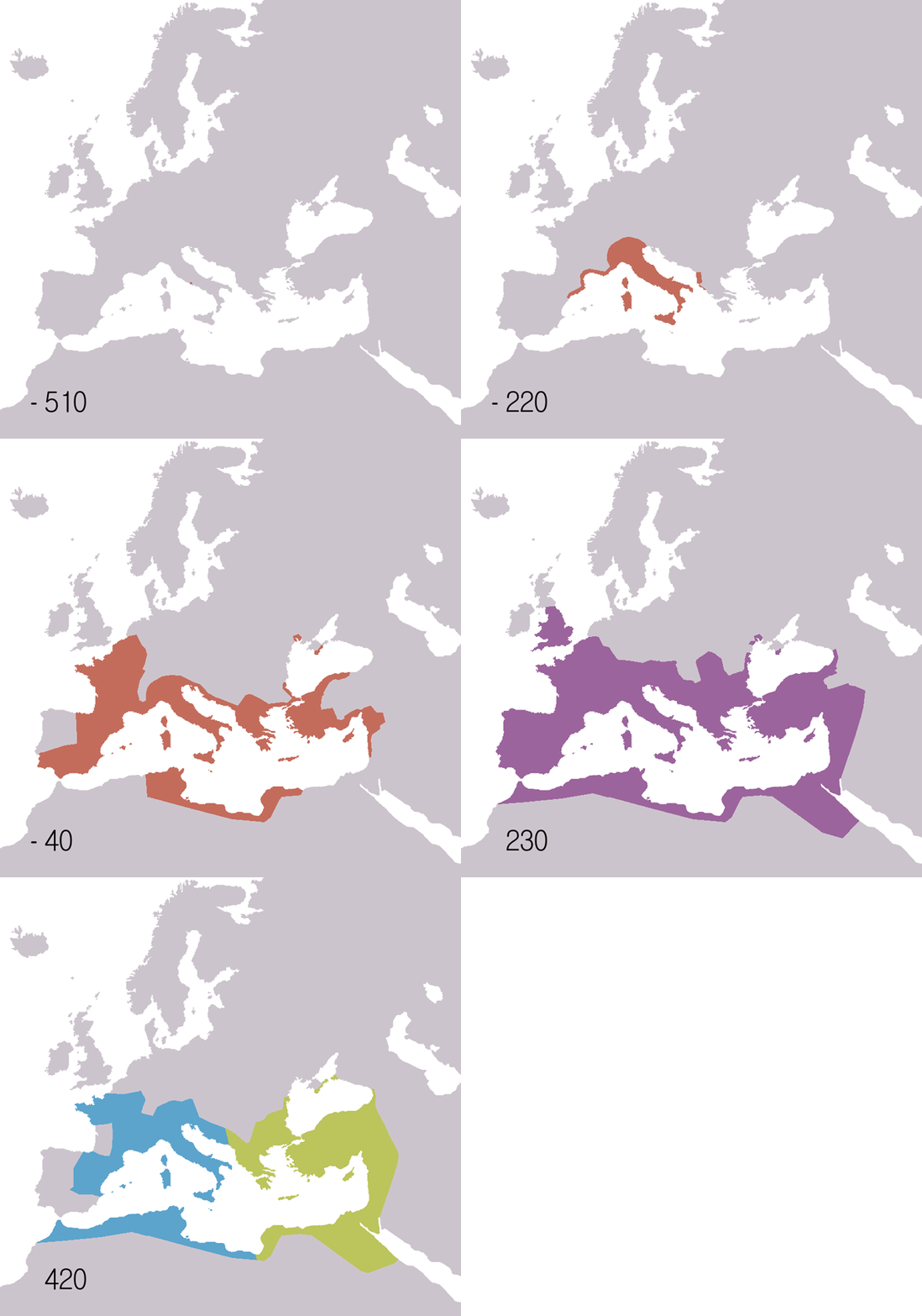
English: Animated map of the Roman Republic and Empire. Displayed in the map:
 
Roman republic 510BC-40BC
 
Roman Empire AD20-AD360
 
Eastern Roman Empire AD405-AD1453
 
Western Roman Empire AD405-AD480
Years shown: 510BC, 320BC, 300BC, 270BC, 220BC, 190BC, 140BC, 70BC, 40BC, AD20, AD70, AD140, AD230, AD300, AD360, AD405, AD420, AD450, AD480, AD530.
Español: Mapa animado de la República y el Imperio Romanos.
 
República Romana 510 a. C.-40 a. C.
 
Imperio Romano 20 d. C.-360 d. C.
 
Imperio Romano de Oriente 405 d. C.-1453 d. C.
Años mostrados en el mapa: 510 a. C., 320 a. C., 300 a. C., 270 a. C., 220 a. C., 190 a. C., 140 a. C., 70 a. C., 40 a. C., 20 d. C., 70 d. C., 140 d. C., 230 d. C., 300 d. C., 360 d. C., 405 d. C., 420 d. C., 450 d. C., 480 d. C., 530 d. C.
Français : Carte animée de la république puis de l'empire Romain.
 
République romaine : de -510 à -40.
 
Empire romain : de 20 à 360.
 
Empire romain d'Orient : de 405 à 1453.
 
Empire romain d'Occident : de 405 à 480.
Années montrées sur la carte : -510, -320, -300, -270, -220, -190, -140, -70, -40, 20, 70, 140, 230, 300, 360, 405, 420, 450, 480, 530.
Русский: Анимированные карты Римской республики и империи. Отображаются на карте:
 
Римская республика 510 до н.э. - 40 до н.э.
 
Римская империя 20 н.э. - 360 н.э.
Годы: 510 г. до н.э., 320 г. до н.э., 300 г. до н.э., 270 г. до н.э., 220 г. до н.э., 190 г. до н.э., 140 г. до н.э., 70 г. до н.э., 40 г. до н.э., 20 г. н.э., 70 г. н.э., 140 г. н.э., 230 г. н.э., 300 г. н.э., 360 г. н.э., 405 г. н.э., 420 г. н.э., 450 г. н.э., 480 г. н.э., 530 г. н.э..
日本語 共和政から帝政のローマ領の変遷。凡例:
 
共和政期 紀元前510年-40年
 
帝政期 20-360年
 
東ローマ帝国 405年-1453年
 
西ローマ帝国 405年-480年(テオドシウス朝と断絶)
年ごとの図: 紀元前510年、紀元前320年、紀元前300年、紀元前270年、紀元前220年、紀元前190年、紀元前140年、紀元前70年、紀元前40年、20年、70年、140年、230年、300年、360年、405年、420年、450年、480年、530年。
Date
Fonte
English:
Español:
  • Mapa de base: Image:BlankMap-Europe-v3.png
  • Fuentes:
    • McEvedy, Colin. Penguin Atlas of Ancient History.
    • Haywood, John. Atlas of Past Times.
    • DK Atlas of world history
  • Véase también los siguientes mapas:
  • Français :
  • Fond de carte basé sur Image:BlankMap-Europe-v3.png
  • Source des données :
    • Colin McEvedy, Penguin Atlas of Ancient History
    • John Haywood, Atlas of Past Times
    • DK Atlas of world history
  • Voir aussi ces cartes :
  • 日本語
  • 背景地図はImage:BlankMap-Europe-v3.pngによる。
  • 出典:
    • McEvedy, Colin; John Woodcock (1988) The Penguin atlas of ancient history. Harmondsworth, Middlesex, England: Penguin Books
    • Haywood, John. (2002/2009) The atlas of past times. London: Brown Reference.
    • Black, Jeremy. DK Atlas of world history(ジェレミー・ブラック総監修『世界史アトラス』の原書)
    • 古代ローマの版図拡大図(地図) テキサス大学Perry-Castañeda Library収蔵
  • 外部リンク:
  • Autor Roke (d)
    Other versions
    English: Version including the Byzantine Empire is at Image:Roman Empire map.gif.
    Español: Image:Roman Empire map.gif: versión que incluye al Imperio Bizantino.
    Français : Image:Roman Empire map.gif : version incluant l'empire byzantin.
    Русский: В том числе версия Византийской империи: Image:Roman Empire map.gif
    日本語 ビザンチン帝国を含む地図 : Image:Roman Empire map.gif
    Camera location47° 00′ 00″ N, 18° 00′ 00″ E  Heading=0° Kartographer map based on OpenStreetMap.View this and other nearby images on: OpenStreetMapinfo

    Autorisation

    I, the copyright holder of this work, hereby publish it under the following license:
    GNU head Permission es concedet por copiar, distribuer e/o modificar ti document sub li conditiones del Autorisation de Documentation Líber del GNU, Version 1.2 o qualcunc version posteriori publicat per li Free Software Foundation; che nequant Section Ínvariant, nequant Textu de Covriment, e nequant Textu de Contra-Covriment. Un copie del autorisation es includet in li section nominat Autorisation de Documentation Líber del GNU.
    w:en:Creative Commons
    atribution distribuer in conditiones de egal autorisation
    Ti file is autorisat sub li autorisation Creative Commons - Atribution-Distribution in Conditiones de Egal Autorisation 3.0 Non-Adaptat.
    Vu es líber:
    • distribuer – a copiar, distribuer e transmisser li labor
    • remixter – adaptar li ovre
    Sub li conditiones quam seque:
    • atribution – Vu deve dar li credite convenent, provider un catenun por li autorisation, e indicar si changes esset fat.

    Vu posse far in qualcunc forme rasonabil, ma ne de forma que suggeste que li autorisator indossa vu o tui usu.

    • distribuer in conditiones de egal autorisation – Si vu remixter, transformar, o constructer sur li materiale, vu deve distribuer tui contributiones sub li autorisation identic o campatabil quam li original.
    This licensing tag was added to this file as part of the GFDL licensing update.

    Captions

    Add a one-line explanation of what this file represents
    Animated map of the Roman Republic and Empire

    Items portrayed in this file

    depicts anglesi

    copyrighted anglesi

    inception anglesi

    6 junio 2006

    media type anglesi

    image/gif

    checksum anglesi

    a7c8c8f3ec123e0e7a45c6ef2d36670a25e83de8

    determination method anglesi: SHA-1 anglesi

    data size anglesi

    103,367 byte

    duration anglesi

    37 Seconde

    height anglesi

    595 pixel

    width anglesi

    626 pixel

    47°0'0.000"N, 18°0'0.000"E

    heading anglesi: 0 degree

    Versiones del file

    Clacca a un date/témpore por vider ti version.

    Version deMiniaturaDimensionesUsatorComentarie
    actual19:14, 22 novembre 2009Miniatura del version de 19:14, 22 novembre 2009626 × 595 (101 KB)SémhurAdding minus sign for BC years.
    09:56, 19 may 2007Miniatura del version de 09:56, 19 may 2007626 × 595 (101 KB)Roke~commonswikiminor - colours of numbers off in last version
    07:31, 19 may 2007Miniatura del version de 07:31, 19 may 2007626 × 595 (71 KB)Roke~commonswikifix area north of hadrians wall
    14:29, 2 julí 2006Miniatura del version de 14:29, 2 julí 2006800 × 760 (218 KB)Roke~commonswikiReverted to earlier revision
    12:05, 6 junio 2006Miniatura del version de 12:05, 6 junio 2006800 × 760 (218 KB)Roke~commonswikispeed up rate to 1 second
    10:58, 6 junio 2006Miniatura del version de 10:58, 6 junio 2006800 × 760 (218 KB)Roke~commonswikimap of the Roman Empire based on Image:BlankMap-Europe-v3.png, displayed in the map: *Red = Roman republic 510BC-40BC *Purple = Roman Empire 20AD-360AD *Blue = Western Roman Empire 4

    Li sequent págine usa ti file:

    Usu global del file

    Li altri wikis a sequer usa ti-ci file:

    Vider plu del usu global de ti-ci file.