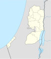
File:West Bank and Gaza Strip location map.svg

Page contents not supported in other languages.
De Wikipedia

Original file((file SVG, nominalmen 639 × 736 pixeles, mesura de file: 98 KB))

Ti file es de Wikimedia Commons e posse esser usat per altri projectes. Li descrition in su págine de descrition es monstrat in infra.

The boundaries on this map show the de facto situation. This is just one of several different views on the subject (see COM:NPOV).

Descrition

Descrition
Deutsch: Positionskarte der Palästinensische Autonomiegebiete bzw. von Westjordanland und Gazastreifen

Quadratische Plattkarte, N-S-Streckung 115 %. Geographische Begrenzung der Karte:

  • N: 32.7° N
  • S: 30.9° N
  • W: 34.0° O
  • O: 35.8° O
English: Location map of the Palestinian territories (West Bank and Gaza Strip)

Equirectangular projection, N/S stretching 115%. Geographic limits of the map:

  • N: 32.7° N
  • S: 30.9° N
  • W: 34.0° E
  • E: 35.8° E
Date
Fonte

Own work using:

  • United States National Imagery and Mapping Agency data
  • World Data Base II data
Autor NordNordWest
Other versions

Derivative works of this file:

SVG genesis
InfoField
 
The source code of this SVG is invalid due to 18 errors.
 
This W3C-invalid map was created with Adobe Illustrator,
 
and with Inkscape.
Kartenwerkstatt
This SVG map has been made or improved in the German Kartenwerkstatt (Map Lab). You can propose maps to improve as well.

Autorisation

I, the copyright holder of this work, hereby publish it under the following licenses:
GNU head Permission es concedet por copiar, distribuer e/o modificar ti document sub li conditiones del Autorisation de Documentation Líber del GNU, Version 1.2 o qualcunc version posteriori publicat per li Free Software Foundation; che nequant Section Ínvariant, nequant Textu de Covriment, e nequant Textu de Contra-Covriment. Un copie del autorisation es includet in li section nominat Autorisation de Documentation Líber del GNU.
w:en:Creative Commons
atribution distribuer in conditiones de egal autorisation
Vu es líber:
  • distribuer – a copiar, distribuer e transmisser li labor
  • remixter – adaptar li ovre
Sub li conditiones quam seque:
  • atribution – Vu deve dar li credite convenent, provider un catenun por li autorisation, e indicar si changes esset fat.

Vu posse far in qualcunc forme rasonabil, ma ne de forma que suggeste que li autorisator indossa vu o tui usu.

  • distribuer in conditiones de egal autorisation – Si vu remixter, transformar, o constructer sur li materiale, vu deve distribuer tui contributiones sub li autorisation identic o campatabil quam li original.
Vu posse selecter li autorisation de tui selection.

Captions

Add a one-line explanation of what this file represents

Items portrayed in this file

depicts anglesi

copyrighted anglesi

inception anglesi

19 novembre 2008

Versiones del file

Clacca a un date/témpore por vider ti version.

Version deMiniaturaDimensionesUsatorComentarie
actual11:35, 28 april 2009Miniatura del version de 11:35, 28 april 2009639 × 736 (98 KB)NordNordWestarea of West Bank back to correct position
02:02, 28 april 2009Miniatura del version de 02:02, 28 april 2009639 × 736 (109 KB)Fjmustak0.85px solid governorate lines (consistent with Israel, Jordan, Lebanon, etc...)
18:58, 22 april 2009Miniatura del version de 18:58, 22 april 2009639 × 736 (98 KB)NordNordWestcorr
02:02, 17 april 2009Miniatura del version de 02:02, 17 april 2009638 × 734 (119 KB)FjmustakAdded governorate boundaries
18:30, 29 novembre 2008Miniatura del version de 18:30, 29 novembre 2008638 × 734 (103 KB)NordNordWest
20:05, 19 novembre 2008Miniatura del version de 20:05, 19 novembre 2008638 × 734 (118 KB)NordNordWest{{Information |Description= {{de|Positionskarte der Palästinensischen Autonomiegebiete bzw. von Westjordanland und Gazastreifen}} Quadratische Plattkarte, N-S-Streckung 115 %. Geographische Begrenzung der Karte:

Li sequent págine usa ti file:

Usu global del file

Li altri wikis a sequer usa ti-ci file:

Vider plu del usu global de ti-ci file.

Metadata