
File:EU location CZE.png

Dimension de ci prevision: 800 × 600 pixeles. Altri resolutiones: 320 × 240 pixeles | 640 × 480 pixeles | 1,024 × 768 pixeles | 1,280 × 960 pixeles | 1,600 × 1,200 pixeles.
Original file (1,600 × 1,200 pixeles, dimension del file: 470 KB, tip MIME: image/png)

|
This locator map image could be re-created using vector graphics as an SVG file. This has several advantages; see Commons:Media for cleanup for more information. If an SVG form of this image is available, please upload it and afterwards replace this template with
{{vector version available|new image name}}.
It is recommended to name the SVG file “EU location CZE.svg”—then the template Vector version available (or Vva) does not need the new image name parameter. |
| Descrition |
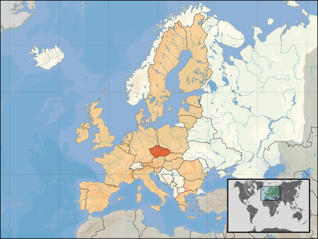
English: Location of the Czech Republic within Europe and the European Union on the 1st of January 2007. |
| Date | |
| Fonte | Propri ovre |
| Autor | David Liuzzo |
| Permission: (Reusant ti-ci file) |
This file is licensed under the Creative Commons Attribution-Share Alike 4.0 International license. Atribution: David Liuzzo
Vu posse far in qualcunc forme rasonabil, ma ne de forma que suggeste que li autorisator indossa vu o tui usu.
|
Versiones del file
Clacca a un date/témpore por vider ti version.
| Version de | Miniatura | Dimensiones | Usator | Comentarie | |
|---|---|---|---|---|---|
| actual | 05:12, 17 may 2007 | | 1,600 × 1,200 (470 KB) | Tene~commonswiki | Optimised (0;4096) |
| 23:55, 22 februar 2007 |  | 1,600 × 1,200 (527 KB) | Tene~commonswiki | Optimised (0) - take 2. | |
| 23:28, 22 februar 2007 |  | 1,600 × 1,200 (711 KB) | Tene~commonswiki | Optimised (0) | |
| 02:05, 1 januar 2007 |  | 1,600 × 1,200 (711 KB) | David Liuzzo | {{Information| |Description= {{de|Lage der Tschechischen Republik in Europa und in der Europäischen Union am 1. Januar 2007 }} {{en|Location of the Czech Republic within [[Europe |
Usu del file
Li sequent págine usa ti file:
Usu global del file
Li altri wikis a sequer usa ti-ci file:
- Usu in az.wiktionary.org
- Usu in bn.wikibooks.org
- Usu in crh.wikipedia.org
- Usu in cs.wikibooks.org
- Usu in cu.wikipedia.org
- Usu in da.wikipedia.org
- Usu in da.wiktionary.org
- Usu in de.wiktionary.org
- Usu in dz.wikipedia.org
- Usu in en.wikibooks.org
- Usu in eo.wikipedia.org
- Usu in fur.wikipedia.org
- Usu in hif.wikipedia.org
- Usu in id.wikibooks.org
- Usu in ik.wikipedia.org
- Usu in it.wikibooks.org
- Usu in it.wikivoyage.org
- Usu in jam.wikipedia.org
- Usu in kk.wikipedia.org
- Usu in kn.wikipedia.org
- Usu in kv.wikipedia.org
- Usu in lb.wiktionary.org
- Usu in ltg.wikipedia.org
- Usu in mhr.wikipedia.org
- Usu in ml.wikipedia.org
- Usu in ms.wikipedia.org
- Usu in nov.wikipedia.org
- Usu in no.wikipedia.org
- Usu in pl.wikinews.org
- Usu in pl.wikiquote.org
- Usu in pl.wikivoyage.org
- Usu in pt.wikipedia.org
- Usu in roa-tara.wikipedia.org
- Usu in ro.wikipedia.org
- Usu in ro.wikibooks.org
Vider plu del usu global de ti-ci file.