
File:Geo-clares.png
Dimension de ci prevision: 424 × 599 pixeles. Altri resolutiones: 170 × 240 pixeles | 566 × 800 pixeles.
Original file (566 × 800 pixeles, dimension del file: 219 KB, tip MIME: image/png)
Descrition
| Descrition |
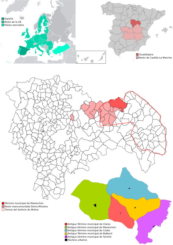
Español: Mapas del término municipal de Maranchón (Guadalajara, España, Europa).
English: Maps from municipality of Maranchón, Guadalajara, Spain, Europe. |
| Date | |
| Fonte | Propri ovre |
| Autor | Javialji |
Autorisation
| I, the copyright holder of this work, release this work into the public domain. This applies worldwide. In some countries this may not be legally possible; if so: I grant anyone the right to use this work for any purpose, without any conditions, unless such conditions are required by law. |
Versiones del file
Clacca a un date/témpore por vider ti version.
| Version de | Miniatura | Dimensiones | Usator | Comentarie | |
|---|---|---|---|---|---|
| actual | 09:27, 23 octobre 2008 | | 566 × 800 (219 KB) | Javialji | {{Information |Description= |Source= |Date= |Author= |Permission= |other_versions= }} |
| 20:31, 14 octobre 2008 |  | 566 × 800 (225 KB) | Javialji | {{Information |Description= |Source= |Date= |Author= |Permission= |other_versions= }} Category:Maps | |
| 21:41, 13 octobre 2008 |  | 283 × 400 (88 KB) | Javialji | {{Information |Description={{en|1=Maps of Clares in Maranchón, Guadalajara, Spain and Europe}} {{es|1=Mapas de Clares in Maranchón, Guadalajara, Spain and Europe}} |Source=trabajo propio (own work) |Author=Javialji |Date=2008-10-13 |Pe |
Usu del file
Li sequent págine usa ti file:
Usu global del file
Li altri wikis a sequer usa ti-ci file:
- Usu in an.wikipedia.org
- Usu in ast.wikipedia.org
- Usu in ca.wikipedia.org
- Usu in ceb.wikipedia.org
- Usu in en.wikipedia.org
- Usu in eo.wikipedia.org
- Usu in es.wikipedia.org
- Usu in eu.wikipedia.org
- Usu in hu.wikipedia.org
- Usu in ia.wikipedia.org
- Usu in it.wikipedia.org
- Usu in lmo.wikipedia.org
- Usu in ru.wikipedia.org
- Usu in simple.wikipedia.org
- Usu in sv.wikipedia.org
- Usu in tt.wikipedia.org
- Usu in vi.wikipedia.org
- Usu in www.wikidata.org
- Usu in zh-min-nan.wikipedia.org