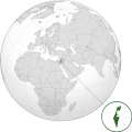
File:Israel (orthographic projection) with disputed territories.svg

Size of this PNG preview of this SVG file: 600 × 600 pixeles. Altri resolutiones: 240 × 240 pixeles | 480 × 480 pixeles | 768 × 768 pixeles | 1,024 × 1,024 pixeles | 2,048 × 2,048 pixeles.
Original file ((file SVG, nominalmen 600 × 600 pixeles, mesura de file: 1.4 MB))
Versiones del file
Clacca a un date/témpore por vider ti version.
| Version de | Miniatura | Dimensiones | Usator | Comentarie | |
|---|---|---|---|---|---|
| actual | 06:15, 4 junio 2019 |  | 600 × 600 (1.4 MB) | Lasunncty | Original vector version found at File:ISR orthographic.svg (as of 16 Sep 2016) |
| 23:44, 24 marte 2019 |  | 2,000 × 2,000 (1.2 MB) | BlueHypercane761 | Fixed image. | |
| 07:31, 24 marte 2019 |  | 2,000 × 2,000 (1.2 MB) | BlueHypercane761 | User created page with UploadWizard |
Usu del file
Hay nequant págine que usa ti file.
Usu global del file
Li altri wikis a sequer usa ti-ci file:
- Usu in ar.wikipedia.org
- معاملة المثليين في إسرائيل
- العلاقات الإثيوبية الإسرائيلية
- مستخدم:جار الله/قائمة صور مقالات العلاقات الثنائية
- العلاقات الأنغولية الإسرائيلية
- العلاقات الإسرائيلية الليختنشتانية
- العلاقات الإسرائيلية البوليفية
- العلاقات الإسرائيلية الموزمبيقية
- العلاقات الألبانية الإسرائيلية
- العلاقات الإسرائيلية البلجيكية
- العلاقات الإسرائيلية البيلاروسية
- العلاقات الإسرائيلية الطاجيكستانية
- العلاقات الإسرائيلية الرومانية
- العلاقات الإسرائيلية الغامبية
- العلاقات الإسرائيلية السيراليونية
- العلاقات الإسرائيلية النيبالية
- العلاقات الإسرائيلية الليبيرية
- العلاقات التشيكية الإسرائيلية
- العلاقات الإسرائيلية الكندية
- العلاقات الإسرائيلية الزيمبابوية
- العلاقات الإسرائيلية البالاوية
- العلاقات الإسرائيلية المالية
- العلاقات الإسرائيلية الفانواتية
- العلاقات الغابونية الإسرائيلية
- العلاقات الإسرائيلية البنمية
- العلاقات الإسرائيلية الكوبية
- العلاقات الإسرائيلية الجورجية
- العلاقات الإسرائيلية الإيطالية
- العلاقات الإسرائيلية الناوروية
- العلاقات الأسترالية الإسرائيلية
- العلاقات الإسرائيلية الزامبية
- العلاقات الإسرائيلية الفيجية
- العلاقات الإسرائيلية المارشالية
- العلاقات الإسرائيلية الكونغوية
- العلاقات الإسرائيلية الدومينيكانية
- العلاقات الإسرائيلية الغرينادية
- العلاقات الإسرائيلية الكازاخستانية
- العلاقات الإسرائيلية الكوستاريكية
- العلاقات الإسرائيلية الباهاماسية
- العلاقات الإسرائيلية البوتانية
- العلاقات الإسرائيلية البنينية
- العلاقات الأندورية الإسرائيلية
- العلاقات الدنماركية الإسرائيلية
- العلاقات الإسرائيلية اللاتفية
- العلاقات الإسرائيلية اللوكسمبورغية
- العلاقات الإسرائيلية السريلانكية
- العلاقات المجرية الإسرائيلية
- العلاقات الإسرائيلية السورينامية
- العلاقات الإستونية الإسرائيلية
- العلاقات المكسيكية الإسرائيلية
- العلاقات الإسرائيلية الهندوراسية
Vider plu del usu global de ti-ci file.
