
File:Kantone der Schweiz.svg

Size of this PNG preview of this SVG file: 800 × 560 pixeles. Altri resolutiones: 320 × 224 pixeles | 640 × 448 pixeles | 1,024 × 717 pixeles | 1,280 × 896 pixeles | 2,560 × 1,792 pixeles | 1,000 × 700 pixeles.
Original file ((file SVG, nominalmen 1,000 × 700 pixeles, mesura de file: 2.86 MB))
Descrition
| Descrition |
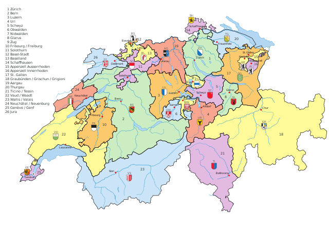
English: Vectormap of Switzerland with all canton, names and flags as separated layers
Deutsch: Vektorkarte der Schweiz mit allen Kantonen, Namen und Flaggen als separate Ebene |
| Date | |
| Fonte | Propri ovre |
| Autor | KarzA |
| Other versions |
[]
Derivative works of this file:
|
| SVG genesis |


Autorisation
| I, the copyright holder of this work, release this work into the public domain. This applies worldwide. In some countries this may not be legally possible; if so: I grant anyone the right to use this work for any purpose, without any conditions, unless such conditions are required by law. |
| Annotations | This image is annotated: View the annotations at Commons |


Versiones del file
Clacca a un date/témpore por vider ti version.
| Version de | Miniatura | Dimensiones | Usator | Comentarie | |
|---|---|---|---|---|---|
| actual | 19:35, 26 julí 2016 | | 1,000 × 700 (2.86 MB) | Pit8404 | Kt. Zug die Fehlende Nummer 9 gesetzt, Appenzell und Waadt korrigiert, bei Graubünden die räto-romanische Bezeichnung hinzugefügt. |
| 03:44, 1 decembre 2009 |  | 1,000 × 700 (2.72 MB) | Inductiveload | missed a couple, try now. <mutter>stupid renderer can't understand manual kerning</mutter> | |
| 03:39, 1 decembre 2009 |  | 1,000 × 700 (2.72 MB) | Inductiveload | the problem is caused by manual kerning of the text. removed that, and it _should_ be OK. | |
| 03:27, 1 decembre 2009 |  | 1,000 × 700 (2.72 MB) | Inductiveload | hmm, that made it worse, try again | |
| 03:21, 1 decembre 2009 |  | 1,000 × 700 (2.72 MB) | Inductiveload | remove underlying borders, move water to a new layer and try to fix text | |
| 02:28, 1 decembre 2009 |  | 1,000 × 700 (2.76 MB) | Inductiveload | convert text to a font that renders better. resize image to a round 1000x700 | |
| 15:50, 9 marte 2009 |  | 1,052 × 744 (2.85 MB) | Ofrick | Korrektur Name Kanton Aargau | |
| 13:34, 9 decembre 2008 |  | 1,052 × 744 (2.85 MB) | KarzA | {{Information |Description={{en|1=Vectormap of Switzerland with all canton, names and flags as separated layers}} {{de|1=Vektorkarte der Schweiz mit allen Kantonen, Namen und Flaggen als separate Ebene}} |Source=Eigenes Werk (own work) |Author=[[User:Karz |
Usu del file
Li sequent págine usa ti file:
Usu global del file
Li altri wikis a sequer usa ti-ci file:
- Usu in ar.wikipedia.org
- Usu in ast.wikipedia.org
- Usu in ckb.wikipedia.org
- Usu in cy.wikipedia.org
- Usu in de.wikipedia.org
- Usu in en.wikipedia.org
- Usu in en.wikivoyage.org
- Usu in hr.wikipedia.org
- Usu in id.wikipedia.org
- Usu in ja.wikipedia.org
- Usu in rm.wikipedia.org
- Usu in sh.wikipedia.org
- Usu in sl.wikipedia.org
- Usu in tl.wikipedia.org