
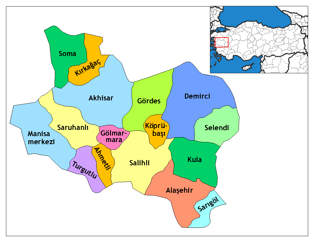
File:Manisa districts.png
Dimension de ci prevision: 776 × 600 pixeles. Altri resolutiones: 311 × 240 pixeles | 621 × 480 pixeles | 994 × 768 pixeles | 1,056 × 816 pixeles.
Original file (1,056 × 816 pixeles, dimension del file: 40 KB, tip MIME: image/png)
Descrition
- Credits
- Created by Rarelibra 16:36, 4 December 2006 (UTC) for public domain use, using MapInfo Professional v8.5 and various mapping resources.
- Edited by One Homo Sapiens Corrected text where İ,Ş,ı,ğ,or ş occurs in name. Source: [statoids-com]. Increased font size and enhanced color differences among adjacent districts.
Autorisation
| I, the copyright holder of this work, release this work into the public domain. This applies worldwide. In some countries this may not be legally possible; if so: I grant anyone the right to use this work for any purpose, without any conditions, unless such conditions are required by law. |
Versiones del file
Clacca a un date/témpore por vider ti version.
| Version de | Miniatura | Dimensiones | Usator | Comentarie | |
|---|---|---|---|---|---|
| actual | 01:35, 29 decembre 2008 | | 1,056 × 816 (40 KB) | One Homo Sapiens | Corrected text where İ,Ş,ı,ğ,or ş occurs in name. Source: [statoids-com]. Increased font size and enhanced color differences among adjacent districts. |
| 16:36, 4 decembre 2006 |  | 1,056 × 816 (35 KB) | Rarelibra | Map of the districts of Manisa province in Turkey. Created by ~~~~ for public domain use, using MapInfo Professional v8.5 and various mapping resources. |
Usu del file
Li sequent págine usa ti file:
Usu global del file
Li altri wikis a sequer usa ti-ci file:
- Usu in ar.wikipedia.org
- Usu in arz.wikipedia.org
- Usu in ast.wikipedia.org
- Usu in azb.wikipedia.org
- Usu in az.wikipedia.org
- Usu in ca.wikipedia.org
- Usu in ceb.wikipedia.org
- Usu in ce.wikipedia.org
- Usu in cs.wikipedia.org
- Usu in diq.wikipedia.org
- Usu in en.wikipedia.org
- Usu in en.wiktionary.org
- Usu in eo.wikipedia.org
Vider plu del usu global de ti-ci file.