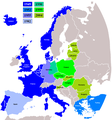
File:NATO expansion.png

Dimension de ci prevision: 720 × 600 pixeles. Altri resolutiones: 288 × 240 pixeles | 576 × 480 pixeles | 922 × 768 pixeles | 1,200 × 1,000 pixeles.
Original file (1,200 × 1,000 pixeles, dimension del file: 76 KB, tip MIME: image/png)
Versiones del file
Clacca a un date/témpore por vider ti version.
| Version de | Miniatura | Dimensiones | Usator | Comentarie | |
|---|---|---|---|---|---|
| actual | 17:25, 3 april 2018 |  | 1,200 × 1,000 (76 KB) | Maphobbyist | Reverted to version as of 09:42, 28 February 2009 (UTC) |
| 15:02, 3 april 2018 |  | 1,280 × 979 (387 KB) | Maphobbyist | Update: Montenegro became a NATO member in 2017 | |
| 09:42, 28 februar 2009 |  | 1,200 × 1,000 (76 KB) | Turkish Flame~commonswiki | better map | |
| 14:39, 20 decembre 2008 |  | 1,210 × 1,298 (91 KB) | IJA | + Gibraltar. Previously important British Military and Naval bases there, also we have included Spanish enclaves. | |
| 05:40, 5 april 2008 |  | 1,210 × 1,298 (91 KB) | Hoshie | fixed Iceland, and the "r" in Turkey | |
| 05:29, 5 april 2008 |  | 1,210 × 1,298 (90 KB) | Hoshie | removed anti-aliasing on country labels | |
| 07:19, 18 julí 2007 |  | 1,210 × 1,298 (97 KB) | Hoshie | The Isle of Man is NOT in the UK! Fixed; under same lic. as original. | |
| 19:33, 25 julí 2006 |  | 1,210 × 1,298 (97 KB) | Satesclop | +Ceuta and Melilla (in Spain) | |
| 15:24, 14 julí 2006 |  | 1,210 × 1,298 (97 KB) | Kseferovic | This is the revised edition of the map that includes the Montenegro split from Serbia. (Also someone neglected to put the Bosnian coatline. | |
| 20:16, 25 junio 2006 |  | 1,210 × 1,298 (103 KB) | Kseferovic | This is a revised edition of the map. It has Serbia and Montenegro divided. There are no coyrights. |
Usu del file
Hay nequant págine que usa ti file.
Usu global del file
Li altri wikis a sequer usa ti-ci file:
- Usu in av.wikipedia.org
- Usu in de.wikipedia.org
- Usu in en.wikipedia.org
- Usu in fr.wikipedia.org
- Usu in ru.wikipedia.org
- Usu in uk.wikipedia.org


