
File:Northern Ireland counties + districts.png

Dimension de ci prevision: 746 × 599 pixeles. Altri resolutiones: 299 × 240 pixeles | 598 × 480 pixeles | 956 × 768 pixeles | 1,275 × 1,024 pixeles | 1,672 × 1,343 pixeles.
Original file (1,672 × 1,343 pixeles, dimension del file: 441 KB, tip MIME: image/png)
Descrition
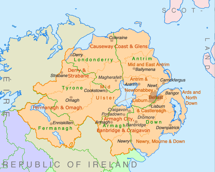
| Descrition | Counties and disticts of Northern Ireland |
| Date | |
| Fonte | File:Counties of Ireland.svg & File:United Kingdom Northern Ireland adm location map.svg |
| Autor | Ulamm (discussion) |
Autorisation
I, the copyright holder of this work, hereby publish it under the following licenses:

|
Permission es concedet por copiar, distribuer e/o modificar ti document sub li conditiones del Autorisation de Documentation Líber del GNU, Version 1.2 o qualcunc version posteriori publicat per li Free Software Foundation; che nequant Section Ínvariant, nequant Textu de Covriment, e nequant Textu de Contra-Covriment. Un copie del autorisation es includet in li section nominat Autorisation de Documentation Líber del GNU. |
This file is licensed under the Creative Commons Attribution-Share Alike 4.0 International, 3.0 Unported, 2.5 Generic, 2.0 Generic and 1.0 Generic license.
- Vu es líber:
- distribuer – a copiar, distribuer e transmisser li labor
- remixter – adaptar li ovre
- Sub li conditiones quam seque:
- atribution – Vu deve dar li credite convenent, provider un catenun por li autorisation, e indicar si changes esset fat.
Vu posse far in qualcunc forme rasonabil, ma ne de forma que suggeste que li autorisator indossa vu o tui usu.
- distribuer in conditiones de egal autorisation – Si vu remixter, transformar, o constructer sur li materiale, vu deve distribuer tui contributiones sub li autorisation identic o campatabil quam li original.
Vu posse selecter li autorisation de tui selection.
Versiones del file
Clacca a un date/témpore por vider ti version.
| Version de | Miniatura | Dimensiones | Usator | Comentarie | |
|---|---|---|---|---|---|
| actual | 22:28, 9 julí 2022 | | 1,672 × 1,343 (441 KB) | Ulamm | some more names |
| 22:31, 8 julí 2022 |  | 1,672 × 1,343 (426 KB) | Ulamm | + some places | |
| 12:38, 6 julí 2022 |  | 1,672 × 1,343 (383 KB) | Ulamm | + Mid Ulster | |
| 12:03, 6 julí 2022 |  | 1,672 × 1,343 (381 KB) | Ulamm | {{Information |Description=Counties and disticts of Northern Ireland |Source=File:Counties of Ireland.svg & File:United Kingdom Northern Ireland adm location map.svg |Date=2022-07-06 |Author=Ulamm (<span class="signature-talk">{{int:Talkpagelinktext}}</span>) |Permission= |other_versions= }} Category:Maps of Northern Ireland Category:Maps by Ulamm == {{int:license-header}} == {{self|GFDL|cc-by-sa-all|migration=redundant}} |
Usu del file
Li sequent págine usa ti file:
Usu global del file
Li altri wikis a sequer usa ti-ci file:
- Usu in de.wikipedia.org
- Usu in mt.wikipedia.org