
File:Philippines location map.svg

Size of this PNG preview of this SVG file: 454 × 599 pixeles. Altri resolutiones: 182 × 240 pixeles | 364 × 480 pixeles | 582 × 768 pixeles | 776 × 1,024 pixeles | 1,552 × 2,048 pixeles | 1,871 × 2,468 pixeles.
Original file ((file SVG, nominalmen 1,871 × 2,468 pixeles, mesura de file: 2.18 MB))
Descrition
| Descrition |
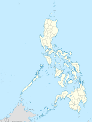
Deutsch: Positionskarte der Philippinen
Quadratische Plattkarte, N-S-Streckung 103 %. Geographische Begrenzung der Karte:
English: Location map of the Philippines
Equirectangular projection, N/S stretching 103 %. Geographic limits of the map:
|
| Date | |
| Fonte |
own work, using
|
| Autor | NordNordWest |
| Other versions |
|


|
This map has been made or improved in the German Kartenwerkstatt (Map Lab). You can propose maps to improve as well.
|
Autorisation
I, the copyright holder of this work, hereby publish it under the following licenses:

|
Permission es concedet por copiar, distribuer e/o modificar ti document sub li conditiones del Autorisation de Documentation Líber del GNU, Version 1.2 o qualcunc version posteriori publicat per li Free Software Foundation; che nequant Section Ínvariant, nequant Textu de Covriment, e nequant Textu de Contra-Covriment. Un copie del autorisation es includet in li section nominat Autorisation de Documentation Líber del GNU. |
This file is licensed under the Creative Commons Attribution 3.0 Unported license.
- Vu es líber:
- distribuer – a copiar, distribuer e transmisser li labor
- remixter – adaptar li ovre
- Sub li conditiones quam seque:
- atribution – Vu deve dar li credite convenent, provider un catenun por li autorisation, e indicar si changes esset fat.
Vu posse far in qualcunc forme rasonabil, ma ne de forma que suggeste que li autorisator indossa vu o tui usu.
Vu posse selecter li autorisation de tui selection.
Versiones del file
Clacca a un date/témpore por vider ti version.
| Version de | Miniatura | Dimensiones | Usator | Comentarie | |
|---|---|---|---|---|---|
| actual | 22:17, 25 marte 2016 | | 1,871 × 2,468 (2.18 MB) | Man77 | upd NIR, Davao |
| 11:46, 14 octobre 2013 |  | 1,871 × 2,468 (2.2 MB) | Hariboneagle927 | fix | |
| 11:07, 14 octobre 2013 |  | 1,871 × 2,468 (2.15 MB) | Hariboneagle927 | fix. Cagayan | |
| 10:58, 14 octobre 2013 |  | 1,871 × 2,468 (2.15 MB) | Hariboneagle927 | Made some update and corrected some minor errors. | |
| 07:22, 9 octobre 2013 |  | 1,871 × 2,468 (2.14 MB) | Hellerick | Regrouped for easier recoloring. | |
| 06:13, 7 august 2013 |  | 1,871 × 2,468 (1.07 MB) | Hellerick | Regional division replaced with provincial division. | |
| 19:09, 5 julí 2009 |  | 1,871 × 2,468 (1,009 KB) | NordNordWest | ||
| 21:04, 25 may 2009 |  | 1,687 × 2,469 (999 KB) | NordNordWest | {{Information |Description= {{de|Positionskarte der Philippinen}} Quadratische Plattkarte, N-S-Streckung 103 %. Geographische Begrenzung der Karte: * N: 21.2° N * S: 4.3° N * W: 115.4° O * O: 127.3° O {{en|Location map of the [[:en |
Usu del file
Hay nequant págine que usa ti file.
Usu global del file
Li altri wikis a sequer usa ti-ci file:
- Usu in af.wikipedia.org
- Usu in als.wikipedia.org
- Usu in an.wikipedia.org
- Usu in az.wikipedia.org
- Usu in be-tarask.wikipedia.org
- Usu in be.wikipedia.org
- Usu in bn.wikipedia.org
- Usu in ce.wikipedia.org
- Usu in ckb.wikipedia.org
- Usu in crh.wikipedia.org
- Usu in cs.wikipedia.org
Vider plu del usu global de ti-ci file.