
File:Philippines location map (Mindanao).svg

Size of this PNG preview of this SVG file: 656 × 486 pixeles. Altri resolutiones: 320 × 237 pixeles | 640 × 474 pixeles | 1,024 × 759 pixeles | 1,280 × 948 pixeles | 2,560 × 1,897 pixeles.
Original file ((file SVG, nominalmen 656 × 486 pixeles, mesura de file: 3.66 MB))
.svg)
Descrition
| Descrition |
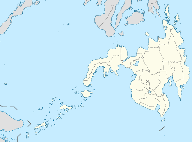
English: Location map of the Philippines (Mindanao)
Equirectangular projection based on the parallel of 10°43' N
|
| Date | |
| Fonte | File:Philippines location map (square).svg |
| Autor | User:Hellerick |
| Other versions |
This file was derived from: Philippines location map (square).svg: .svg) |
Autorisation
Ti file is autorisat sub li autorisation Creative Commons - Atribution-Distribution in Conditiones de Egal Autorisation 3.0 Non-Adaptat.
- Vu es líber:
- distribuer – a copiar, distribuer e transmisser li labor
- remixter – adaptar li ovre
- Sub li conditiones quam seque:
- atribution – Vu deve dar li credite convenent, provider un catenun por li autorisation, e indicar si changes esset fat.
Vu posse far in qualcunc forme rasonabil, ma ne de forma que suggeste que li autorisator indossa vu o tui usu.
- distribuer in conditiones de egal autorisation – Si vu remixter, transformar, o constructer sur li materiale, vu deve distribuer tui contributiones sub li autorisation identic o campatabil quam li original.
Versiones del file
Clacca a un date/témpore por vider ti version.
| Version de | Miniatura | Dimensiones | Usator | Comentarie | |
|---|---|---|---|---|---|
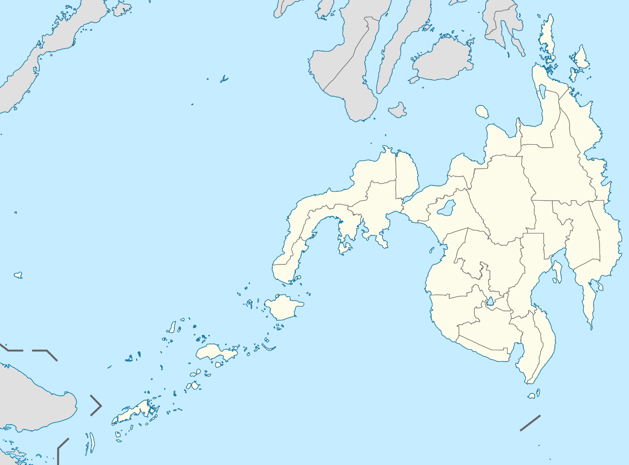
| actual | 07:11, 17 may 2021 | | 656 × 486 (3.66 MB) | Petriolo | Reverted to version as of 05:35, 3 May 2021 (UTC) The new administrative borders are based from the Philippine government websites (https://www.geoportal.gov.ph/; http://noah.up.edu.ph/), and is deemed accurate. These new files have reliable sources and there's no "beauty" in it if it is inaccurate in the first place. |
| 14:02, 16 may 2021 |  | 656 × 486 (2.22 MB) | AichiWikiFixer | Reverted to version as of 14:34, 27 October 2017 (UTC) (Borders seen as ugly) | |
| 05:35, 3 may 2021 |  | 656 × 486 (3.66 MB) | Petriolo | updated with NAMRIA borders | |
| 14:34, 27 octobre 2017 |  | 656 × 486 (2.22 MB) | Mliu92 | Changed crop to add missing island. | |
| 17:23, 26 octobre 2017 |  | 573 × 573 (2.22 MB) | Mliu92 | User created page with UploadWizard |
Usu del file
Hay nequant págine que usa ti file.
Usu global del file
Li altri wikis a sequer usa ti-ci file:
- Usu in azb.wikipedia.org
- Usu in en.wikipedia.org
- Xavier University – Ateneo de Cagayan
- Moro Gulf
- Mindanao State University
- Ateneo de Davao University
- Francisco Bangoy International Airport
- Agusan del Sur State University
- Zamboanga International Airport
- Dipolog Airport
- Laguindingan Airport
- General Santos International Airport
- Cotabato Airport
- Pagadian Airport
- Surigao Airport
- Bancasi Airport
- Sanga-Sanga Airport
- Sayak Airport
- Bukidnon State University
- Mindanao State University–Iligan Institute of Technology
- La Salle University (Ozamiz)
- Mountain View College (Philippines)
- De La Salle John Bosco College
- Central Mindanao University
- University of the Philippines Mindanao
- Iligan Medical Center College
- Camiguin Airport
- Jolo Airport
- Labo Airport
- Father Saturnino Urios University
- Notre Dame of Marbel University
- Notre Dame of Dadiangas University
- Caraga State University – Cabadbaran Campus
- Fort Pilar
- Mindanao State University–Naawan
- University of Science and Technology of Southern Philippines
- Liceo de Cagayan University
- Cagayan de Oro College
- Misamis University
- San Pedro College
- University of the Immaculate Conception
- Assumption College of Davao
- Basilan State College
- 1976 Moro Gulf earthquake
- St. Michael's College (Iligan)
- University of Mindanao
- Saint Michael College of Caraga
- Colegio de Kidapawan
- List of Philippine Basketball Association playing venues
- Holy Cross of Davao College
- San Agustin Institute of Technology
Vider plu del usu global de ti-ci file.
.svg)
.svg)