
File:Relief map of Solomon Islands.png

Dimension de ci prevision: 800 × 460 pixeles. Altri resolutiones: 320 × 184 pixeles | 640 × 368 pixeles | 945 × 543 pixeles.
Original file (945 × 543 pixeles, dimension del file: 407 KB, tip MIME: image/png)
Descrition
| Descrition |
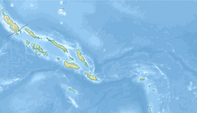
Русский: Физическая карта Соломоновых островов.
English: Relief map of Solomon Islands.
Equirectangular projection. Geographic limits of the map:
|
| Date | |
| Fonte |
|
| Autor | Nzeemin |
| Other versions |
|

Autorisation
I, the copyright holder of this work, hereby publish it under the following license:
Ti file is autorisat sub li autorisation Creative Commons - Atribution-Distribution in Conditiones de Egal Autorisation 3.0 Non-Adaptat.
- Vu es líber:
- distribuer – a copiar, distribuer e transmisser li labor
- remixter – adaptar li ovre
- Sub li conditiones quam seque:
- atribution – Vu deve dar li credite convenent, provider un catenun por li autorisation, e indicar si changes esset fat.
Vu posse far in qualcunc forme rasonabil, ma ne de forma que suggeste que li autorisator indossa vu o tui usu.
- distribuer in conditiones de egal autorisation – Si vu remixter, transformar, o constructer sur li materiale, vu deve distribuer tui contributiones sub li autorisation identic o campatabil quam li original.
Versiones del file
Clacca a un date/témpore por vider ti version.
| Version de | Miniatura | Dimensiones | Usator | Comentarie | |
|---|---|---|---|---|---|
| actual | 16:26, 20 novembre 2012 | | 945 × 543 (407 KB) | Nzeemin | User created page with UploadWizard |
Usu del file
Hay nequant págine que usa ti file.
Usu global del file
Li altri wikis a sequer usa ti-ci file:
- Usu in ast.wikipedia.org
- Usu in az.wikipedia.org
- Usu in be.wikipedia.org
- Usu in bn.wikipedia.org
- Usu in cs.wikipedia.org
- Usu in da.wikipedia.org
- Usu in de.wikipedia.org
Vider plu del usu global de ti-ci file.