
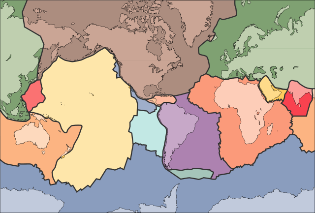
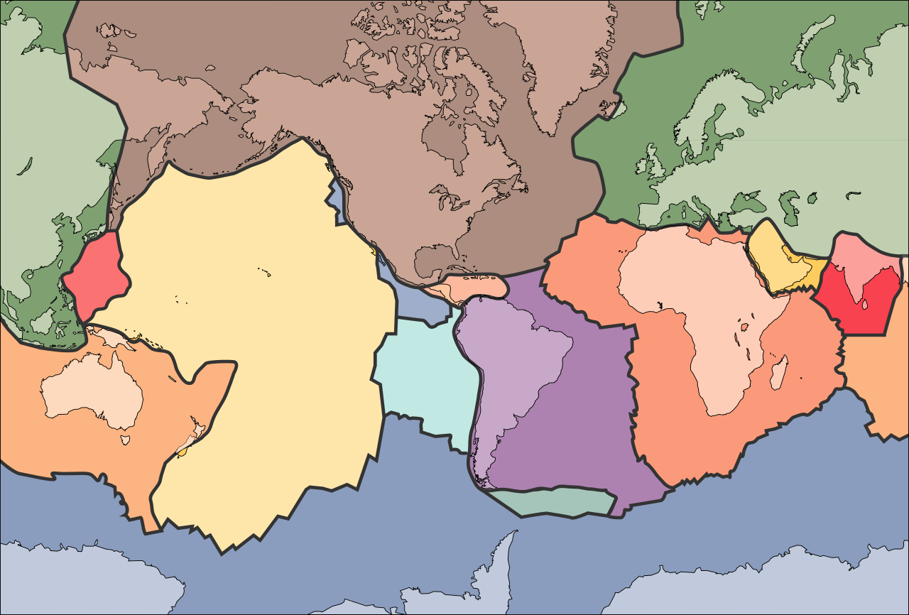
File:Tectonic plates (empty).svg

Size of this PNG preview of this SVG file: 681 × 461 pixeles. Altri resolutiones: 320 × 217 pixeles | 640 × 433 pixeles | 1,024 × 693 pixeles | 1,280 × 866 pixeles | 2,560 × 1,733 pixeles.
Original file ((file SVG, nominalmen 681 × 461 pixeles, mesura de file: 356 KB))
الخلافه الرشيديهkp
Descrition
| Descrition | |
| Date | 10 septembre 2005 (upload date) |
| Fonte | File:Tectonic plates (empty).png |
| Autor | Ævar Arnfjörð Bjarmason |
| Other versions |
This file was derived from: Tectonic plates (empty).png:
[]
|
| SVG genesis | This W3C-invalid map was created with Adobe Illustrator, and with Inkscape. |


.png)


.svg)
.png)
Autorisation
This image is in the public domain in the United States because it only contains materials that originally came from the United States Geological Survey, an agency of the United States Department of the Interior. For more information, see the official USGS copyright policy.
|
Versiones del file
Clacca a un date/témpore por vider ti version.
| Version de | Miniatura | Dimensiones | Usator | Comentarie | |
|---|---|---|---|---|---|
| actual | 02:04, 11 octobre 2006 | | 681 × 461 (356 KB) | Sting | Borders correction integrated to the continents borders; size of picture |
| 16:29, 10 octobre 2006 |  | 682 × 462 (285 KB) | Rogilbert~commonswiki | correction de frontières 2 | |
| 16:14, 10 octobre 2006 |  | 682 × 462 (212 KB) | Rogilbert~commonswiki | correction des frontière | |
| 13:48, 10 septembre 2005 |  | 682 × 462 (199 KB) | Ævar Arnfjörð Bjarmason | SVG version of Image:Tectonic plates (empty).png {{PD-USGov-USGS}} Category:Plate tectonics |
.png)
Usu del file
Hay nequant págine que usa ti file.
Usu global del file
Li altri wikis a sequer usa ti-ci file:
- Usu in ar.wikipedia.org
- Usu in az.wikipedia.org
- Usu in bn.wikipedia.org
- Usu in en.wikipedia.org
- Earth
- Internal structure of Earth
- Wikipedia:Graphics Lab/Image workshop/Archive/Jan 2009
- User:AvionArchon/sandbox
- User:Darth Tacker/TWA/Earth
- User:CheChe/Spoken Script
- User:Zanygenius/TWA/Earth
- User:Zanygenius/TWA/Earth/2
- User:Google7722/TWA/Earth
- Portal:Geophysics
- Portal:World
- User:FreshYoMama/TWA/Earth
- User:FreshYoMama/TWA/Earth/2
- Usu in en.wikiversity.org
- Usu in eo.wikipedia.org
- Kontinento
- Platotektoniko
- Litosfero
- Tektona plato
- Ŝablono:Tektonaj platoj
- Antarkta plato
- Eŭrazia plato
- Nordamerika plato
- Sudamerika plato
- Afrika plato
- Pacifika plato
- Hindia plato
- Aŭstralia plato
- Plato Nazca
- Anatolia plato
- Arabia plato
- Filipina plato
- Kokosa plato
- Karibia plato
- Plato Juan de Fuca
- Hind-Aŭstralia Plato
- Usu in es.wikipedia.org
- Usu in fa.wikipedia.org
- Usu in fr.wikipedia.org
- Usu in gl.wikipedia.org
- Usu in hu.wikipedia.org
- Usu in id.wikipedia.org
- Usu in io.wikipedia.org
Vider plu del usu global de ti-ci file.
.svg)
.svg)