
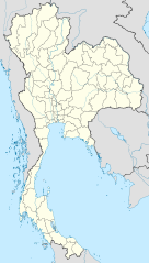
File:Thailand location map.svg

Size of this PNG preview of this SVG file: 341 × 600 pixeles. Altri resolutiones: 136 × 240 pixeles | 273 × 480 pixeles | 436 × 768 pixeles | 582 × 1,024 pixeles | 1,164 × 2,048 pixeles | 1,051 × 1,849 pixeles.
Original file ((file SVG, nominalmen 1,051 × 1,849 pixeles, mesura de file: 662 KB))
Descrition
| Descrition |
Deutsch: Positionskarte von Thailand
Quadratische Plattkarte, N-S-Streckung 103 %. Geographische Begrenzung der Karte:
English: Location map of Thailand
Equirectangular projection, N/S stretching 103 %. Geographic limits of the map:
|
| Date | |
| Fonte |
Propri ovre, using
|
| Autor | NordNordWest |

|
This map has been made or improved in the German Kartenwerkstatt (Map Lab). You can propose maps to improve as well.
|
Autorisation
I, the copyright holder of this work, hereby publish it under the following licenses:

|
Permission es concedet por copiar, distribuer e/o modificar ti document sub li conditiones del Autorisation de Documentation Líber del GNU, Version 1.2 o qualcunc version posteriori publicat per li Free Software Foundation; che nequant Section Ínvariant, nequant Textu de Covriment, e nequant Textu de Contra-Covriment. Un copie del autorisation es includet in li section nominat Autorisation de Documentation Líber del GNU. |
This file is licensed under the Creative Commons Attribution 3.0 Unported license.
- Vu es líber:
- distribuer – a copiar, distribuer e transmisser li labor
- remixter – adaptar li ovre
- Sub li conditiones quam seque:
- atribution – Vu deve dar li credite convenent, provider un catenun por li autorisation, e indicar si changes esset fat.
Vu posse far in qualcunc forme rasonabil, ma ne de forma que suggeste que li autorisator indossa vu o tui usu.
Vu posse selecter li autorisation de tui selection.
Versiones del file
Clacca a un date/témpore por vider ti version.
| Version de | Miniatura | Dimensiones | Usator | Comentarie | |
|---|---|---|---|---|---|
| actual | 13:05, 22 marte 2011 | | 1,051 × 1,849 (662 KB) | NordNordWest | update, new province |
| 18:00, 14 april 2009 |  | 1,052 × 1,849 (1.04 MB) | NordNordWest | corr | |
| 19:57, 29 marte 2009 |  | 1,053 × 1,852 (924 KB) | NordNordWest | corr | |
| 18:03, 29 marte 2009 |  | 1,053 × 1,852 (924 KB) | NordNordWest | corr | |
| 19:08, 28 marte 2009 |  | 1,053 × 1,852 (925 KB) | NordNordWest | {{Information |Description= {{de|Positionskarte von Thailand}} Quadratische Plattkarte, N-S-Streckung 103 %. Geographische Begrenzung der Karte: * N: 20.6° N * S: 5.4° N * W: 97.1° O * O: 106.0° O {{en|Location map of [[:en:Thailand|T |
Usu del file
Hay nequant págine que usa ti file.
Usu global del file
Li altri wikis a sequer usa ti-ci file:
- Usu in af.wikipedia.org
- Usu in als.wikipedia.org
- Usu in an.wikipedia.org
- Usu in ar.wikipedia.org
- Usu in ast.wikipedia.org
- Usu in az.wikipedia.org
- Usu in ba.wikipedia.org
- Usu in be-tarask.wikipedia.org
- Usu in be.wikipedia.org
Vider plu del usu global de ti-ci file.